Garmin
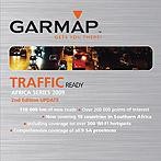
GARMAP Southern Africa Streetmaps (Topographical and Recreational) 2009 - TMC (SD Card)
- SD Card includes routable road data for South Africa, Botswana, Lesotho, Malawi, Mozambique, Namibia, Swaziland, Zambia, Zimbabwe and Angola
Mnf. #: 9401
SKU: 17340
Warranty: 1 year
Southern Africa Streetmaps (Topographical and Recreational) 2009
- This product successfully allows for the convergence of the serious outdoor enthusiast and the pavement pioneer. Detailed topographical and recreational information seamlessly overlays with the Southern Africa Streetmaps product providing a comprehensive Southern Africa map base for recreational planning and orientation. Topographic information includes 20m contours, rivers and forests for the nine southern African countries and farm boundary data for South Africa and Namibia.
Product Benefits
- The software is designed for managing track, route and way-point information which can be used on your PC or loaded onto your GPS itself. The seamless routing between the different countries allows you to accurately plan and navigate to destinations within the Southern Africa region. Search capabilities on a comprehensive list of street addresses and places of interest such as farm names, service stations, banks and businesses allow you to quickly find and route to your destination. The additional topographic information will help guide you through specific areas of interest.
Product Features
- Comprehensive street level detail for all cities and selected towns in the southern Africa region. Includes major cities such as Windhoek, Gaborone, Harare, Maputo, Johannesburg, Pretoria, Cape Town, Durban and Port Elizabeth and many more.
Data features include:
- More than 890 000km of routable road data across South Africa, Botswana, Lesotho, Malawi, Mozambique, Namibia, Swaziland, Zambia, Zimbabwe and Angola
- Additional roads incorporated from Department Surveys and Mapping: South Africa
- Street level data for more than 1700 cities, towns and villages in Southern Africa
- More than 270 000 points of interest
- Updated information for selected existing cities and towns
- Farm and farm portion boundaries and names for South Africa and Namibia
- 20m contour data
General |
||
| Device Compatibility | ||
| Continents | Africa | |
| Region | ||
| Countries | Angola Botswana Lesotho Malawi Mozambique Namibia South Africa Swaziland Zambia Zimbabwe | |
| Map Type | Recreational Routable Topographic | |
| Media Type | SD Card | |